Showing posts with label Navigation. Show all posts

Wednesday, April 25, 2012

NavDroyd v1.3.3 APK

Best Blog Tips
| |
0 comments
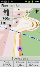
Onboard/Offline GPS Navigation App
- worldwide 2D/3D OSM maps
- turn-by-turn routing/navigation
- voice/audio guidance (>1.6)
- car/pedestrian routing (bike to come)
- local search (places/POI)
- visual/audio speed warning
- map themes (day/night/outdoor)
- frequent map updates
- no cellular network required
- no hidden roaming costs
Download

Friday, March 23, 2012

Locus Pro v2.1.1 APK + Addons

Best Blog Tips
| |
0 comments

MULTI-FUNCTION TOURIST NAVIGATION

Irreplaceable application for hiking, geocaching and your everyday life.

Locus offers many useful features such as:
- Online maps mapy (Openstreetmap - OSM, Freemap, SHOCart, MapQuest, Navigasi, Turaterkep, NzTopoMaps, Osmapa.pl)
- Offline maps (Support for formats SQLite, TAR maps, MBT maps, GEMF, Rmap)
- Navigation (online calculation tracks)
- Vector maps
- WMS service
- Track record
- Integration of Google My Maps (reading and editing)
- Geocaching
- Parking
- Weather service
- Point of interest
- POI alert
- Search (by adress, coordinates, contact)
- Custom screen (created by community)
- Integration of GPSies, Breadcrumbs, Street View and other
- API for developers
- Work with KML, GPX, OpenAir, DXF formats
- Add-ons (GeoGet database, GSAK database, Vector maps, Augmented reality, Foursquare, etc.)

What's in this version:
‎*** 2.1.1 ***
mainly bug-fix release. Thanks all for report!
add: improved filter on Points manager screen
add: ability to go from track point to chart with highlighted position
chg: faster startup and better memory handling on startup
fix: problems with licence at start
fix: problem with adding program link to right panel
fix: some rare crashes at startup
fix: hiding of points and tracks on map after app restart
fix: and some other small reported issues

Instructions:
1. Install Locus Pro and don't run.
2. Install Lucky Patcher (Run and Custom patch!)
3. Enjoy
Download

Friday, March 16, 2012

Google Maps v6.4.0 APK

Best Blog Tips
| |
0 comments

Get Google Maps with Navigation (Beta), Places, and Latitude

*Navigation: Free, voice-guided GPS navigation system
*Places: Find, rate, and get recommendations for places
*Latitude: See friends on the map and check in at places

What's in this version:
New, simplified menu for Google Maps Navigation (Beta)

Download

Tuesday, March 13, 2012

OpenSignalMaps v1.21 APK

Best Blog Tips
| |
0 comments
The ultimate wifi and signal finding tool. Supports GSM, CDMA, 4G, 3G, 2G.
The best toolkit for improving your cellular and wifi signal.
- Signal direction
- Signal graph
- Map and radar views of cell towers & WiFi routers
- Detailed signal strength data
- Save data to SD card
- Widget
- Save wifi access points and maps of their locations by running the speed test
- Option to notify you at loss of signal (entering "deadzones")
- History of signal readings

The simplest tactic to improve your reception is to walk in the direction of your signal. Not foolproof, but worth a shot!
Option to contribute to the OpenSignalMaps.com project: we're TRUE coverage maps of cell phone networks & wifi data points freely available to all.
Supports almost all Android devices:
from small screened devices (HTC Wildifre) on 1.5 (Cupcake) up to your flashy Galaxy Nexus on 4.0 (Icecream Sandwich). We also support devices without Google APIs.
Problems? Email us!
Tips:
- Click the wifi-cells toggle button on the bottom left to see wifi routers
- Use wifi and GPS for best speed and accuracy
- Verizon & Sprint users will see only one connected tower at a time
- Not all towers and wireless routers are in our database. Sorry!
- Moving in the direction of your cell tower will not always improve reception due to interference effects and local geography.
- Data is mainly crowd sourced - wireless and antenna locations are calculated by triangulation. This means they are not exact, and sometimes they may be way off. As more people use this app the data will improve.
- Click on the "i" on the overview screen to see more signal stats - including signal RSSI in ASU and dBm - comprehensive field test mode.
- Export speed test results, cell signal and wifi routers as CSV to SDCard so you can analyse as you wish.

Advanced notes:
- For GSM, cell tower are identified via cell id and location area code (CID and LAC)
- For CDMA, cell towers are identified via Network ID, Base sub-station ID and system ID (NID, BSSID and SID). CDMA phones include the Droid (II, X, HD, etc.), EVO 4G - all phones on Verizon and Sprint.
- See our website opensignalmaps.com for more detail on using the app and please add your requests for developments.
- For tablets (somde models of Xoom, Asus Transformer and others) that do not have cell radios the app will only work in wifi mode
- For devices that do not have access to google APIs OpenStreetMaps are used
- For the Galaxy S2 there is an issue reading the signal strength, this is a bug and effects all signal apps, however the app does show cell tower location as normal and works in wifi mode perfectly
- This app is developed on a Nexus One, but tested on many phones (I also have a HTC Hero still on 1.5!), let us know any problems. Sorry if we're slow in replying, but we read every email.
We're building trustworthy and comprehensive coverage maps for GSM, CDMA; for 2G, 3G & 4G. We think this is the best signal tool you can find, let us know if you think anything is missing.

Networks we're mapping: Orange, Vodafone, O2, 3, AT&T, Sprint, Verizon, Movistar, Claro. And over a hundred others.

Download

Saturday, March 10, 2012

GPS Essentials Donation Plugin v1.0.1 APK

Best Blog Tips
| |
0 comments
Support new features in GPS Essentials
Support development of GPS Essentials by purchasing this plugin.
As a goody, GPS Essentials will run ads-free on your phone when this plugin is installed.
Please send an email if you have problems.
Note: You have to restart GPS Essentials to make the ads disappear after installing this plugin.
Download

Saturday, March 03, 2012

PathAway GPS Express Edition v5.61.04.01 APK

Best Blog Tips
| |
0 comments
Outdoor GPS Navigation, Tracking, and Mapping app for recreational or pro use.
Powerful and versatile GPS application for any outdoor recreational or professional use. Record tracks, capture points, create and follow routes, navigate with online, cached, or custom imported maps. The Express Edition is a fully customizable navigation and mapping solution with support for customized PathAway maps. Use the PathAway tools to create and calibrate your own layered maps. Any digitized map can be turned into a moving map navigational chart. PathAway maps can also be created or acquired from third-party sources. Visit http://pathAway.com for links to PathAway map sources.
PathAway's powerful feature-set makes it useful for backcounty and outdoor adventure or any off-road GPS activity such as aviation, boating, off-road driving, hiking, cycling, touring, Geocaching, rally racing, motorcycle touring, running and athletic training, ballooning, fishing, hunting, paragliding, mountain climbing, ultra-light flying, canoeing, snowmobiling, scuba diving, outdoor education, mapping/GIS, mining, military training, surveying, site inspection, telematics, field data collection, search and rescue, or any application where location is important.
Features:
- Tried and tested software base developed with user feedback over the last 10 years on many different mobile device platforms;
Maps:
- Use online maps from Google maps, OpenStreetMap, OpenCycleMap (Topo), USGS Topos and aerials, FAA USA Aviation charts, ArcGIS World and USA Topographic, Natural Resources Canada topographic maps;
- Maps are downloaded on-the-fly as you travel;
- Maps are cached for off-line use when connectivity is not available;
- Import and use customized PathAway maps created using PathAway Map Creation Tools or 3rd party Mapping Applications;
Tracking:
- perform extensive GPS track logging limited only by system memory;
- track in the background while using other applications or with the device locked.
- Pause and continue track timer for precision timing;
- One touch "BackTrack" feature to find your way home after recording your way out;
- Manage and Edit Track logs and track points;
Points:
- Capture points, describe by name, icon, description, photo from gallery or camera;
- Over 100 icons to choose from;
- Manage and Edit Points;
- Organize your points by creating multiple Points Databases;
Navigation:
- Navigate using point-to-point or multi-point routes;
- Create navigational routes simply be tapping on the map to add or insert route points;
- Proximity to point and off-track Alarms;
- Auto Rotate maps to direction of travel
- Uses build-in magnetic compass for slow speed directional location. Great for Geocaching when you’re trying to pin-point a cache..
- View navigational information on a customizable dashboard;
- Map View or Compass and Info Views;
- Multiple coordinate grid and datum display including lat/long, UTM, OSGB, MGRS, MGA, GGRS87, Warschauer, Localized Grids for Austria, Germany, Quebec, Sweden, Switzerland, Israel.
- Import/Export GPX, KML, KMZ, and PathAway delimited files.
Download

Like Us On Facebook

Dont Forget to Like on Facebook to receive Updates.
Powered by Blogger.

ShareThis